Korean Demilitarized Zone – the most militarized zone ever

Hot on the heels of Vice President Joe Biden, Tony, Meg and I visited Korea’s Demilitarized Zone Saturday. Three weeks after Biden attended a ceremony for U.S. troops who died during the Korean War, we stood in the same spot as he did, surrounded on three sides by North Korea at the Joint Security Area.

We caught a tour bus at Osan Air Base at 7:30 a.m. and drove about 2 hours to the first stop: Imjingak, a park 4.4 miles south of the military demarcation line, where 12,773 Korean prisoners of war crossed the “Bridge of Freedom” from North Korea in 1953. The park features several war memorials, including a 21-ton Bell of Peace.

View from the rooftop.

Meg at the Bridge of Freedom.

Tourists tie ribbons on the fence with wishes for peace and reunification.

As usual, the fascinating history unveiled during our daylong tour was news to me. Declared an Imperial Japanese protectorate in 1905, Korea became an independent nation with the defeat of Japan at the end of World War II. With the Allied victory in 1945, the Soviet Union and the United States agreed to share temporary trusteeship of Korea, dividing the country roughly along the 38th parallel. Very different political and economic visions (communism in the north, democracy in the south) led to philosophical and, eventually, literal division of the country under different rulers. The Korean War, from 1950-53, saw both sides nearly take over the entire peninsula, but ultimately the Korean Armistice Agreement made the North-South division permanent. Both sides agreed to a demilitarized zone (DMZ), which stretches 250 kilometers (160 miles) across the country with a 2-kilometer (1.25-mile) buffer on each side of the dividing line.

Our second stop on the tour was DMZ Tunnel #3, one of four known tunnels built by North Korea. Tunnel #3, discovered in 1978 based on information from a defector, runs for a mile through bedrock about 240 feet underground. It was capable of moving a full military division (30,000 soldiers) each hour, and was apparently designed for a surprise attack on Seoul, less than an hour’s drive away.

We weren’t allowed to take pictures at the tunnel, dang it, but it was amazing! We walked down a steep incline to get to the actual tunnel. (Thank goodness they provided hard hats; I bonked my head on several low hanging sections of rock.) North Korea had painted the walls black and claimed the tunnel was a mine shaft. However, geologists say there’s no coal in this region. Tourists were allowed to walk about 1,600 feet into the tunnel before encountering the first of three blockades erected by the South. At that point, we were just 500 feet from North Korea. The North likely dug many more tunnels through the DMZ, but they remain to be found.

Our tour guide, Mr. Oh, in front of the tunnel map.

Next stop: Dora Observation Point, located at the northernmost point of the Military Demarcation Line. From the overlook, we could see both DMZ villages. Megan even spotted a few North Koreans through the binoculars.

South Korea’s Tae Sung Dong, or “Freedom Village,” is home to about 225 residents, who are required to stay there 240 days out of the year and observe an 11 p.m. curfew. Here’s an interesting article from CNN on the village: Life on the Edge in Freedom Village.

The North Korean village of Kijong-dong, or “Propaganda Village,” has always been uninhabited, and our military escort said the buildings are really facades with painted-on windows and doors. Until 2004, the village blasted communist propaganda encouraging South Korean defectors. A 525-foot flagpole (supposedly the tallest in the world) waves a North Korean flag weighing nearly 600 pounds.

This South Korean Army soldier insisted we stay behind a designated photo spot to take pictures.

But here’s a poster that showed our view of the North Korean village.

After a tasty Korean buffet lunch, we visited the Mt. Dora Train Station, where commuters can ride into North Korea for work at an industrial complex. The station was built in anticipation of rail service between Seoul and Pyeongyang. Maybe some day.

Our final stop was the most exciting: the Joint Security Area (JSA). Our tour group had to follow Pvt. Tekamp in two lines through the Freedom House (built for North and South Korean families to reunite, but that never happened) and out to the buildings where the two Koreas hold diplomatic meetings. South Korean soldiers stood guard in a taekwondo bulldog stance, facing north.

We spotted just one North Korean soldier on the steps of the Panmungak building. Here he is, and check out the binoculars in the window! It felt like we were stepping into a spy novel.

Inside one of the buildings (where microphones on the table relay everything to soldiers on both sides), Tony straddled the line between North and South Korea.

Here’s Megan with the South Korean guard (known as a Republic of Korean – or ROK – soldier) next to the table where microphones are lined up along the north-south dividing line.

This is the spot at the JSA where the demarcation line makes a sharp bend, so standing at the apex of the angle allows visitors to be surrounded on three sides by North Korea. That’s the North Korean flagpole on the left.

From the same point, we could see the “Bridge of No Return,” which was used for prisoner exchanges.

Next to the bridge sits a marker commemorating an event in DMZ history that nearly triggered another Korean war.

The Axe Murder Incident occurred on August 18, 1976, when CPT Arthur Bonifas, commander of the security company at the JSA and his executive officer, 1LT Mark Barrett, led a detail to trim a poplar tree that was obscuring the view of a United Nations Command checkpoint. Because the checkpoint was so close to the military demarcation line, guards were particularly susceptible to attack or kidnapping. The website ROKDrop has an excellent account of the incident.

Here’s the checkpoint as seen from the observation point. The gap in the trees was where the divisive poplar once stood.

In a nutshell, North Korean soldiers attacked the tree trimmers with their own axes, killing Bonifas and Barrett. In response, the UN Command decided instead of trimming the tree, they were going to cut it down. Operation Paul Bunyan was an overwhelming show of force designed to get the job done without escalating the tension between the two Koreas. Wikipedia has some fascinating details about the operation.

Capt. Bonifas’s wife, Marcia, was my mom’s neighbor at West Point at the time of the Axe Murder Incident. My mother recalls that Marcia was expecting her husband home in just three weeks when she got the news that he was brutally murdered. Megan says she’s heard the story many times, but visiting the DMZ made the story so much more real.

Beef on a Leaf – Korean Barbecue

Just down the hill from my sister’s house in Korea sits a nondescript hole-in-the-wall restaurant. I can’t even tell you what’s it’s called. What I can tell you is that the food is delicious!

Britt’s buddy Oliver – aka Slim (all the pilots have call signs) – is stationed here unaccompanied, but his wife, Heather, was in town for the week, so they joined us for dinner Sunday night. Nobody working at the restaurant spoke English, much less offered English-language menus.

Slim confidently ordered, “Two beef, one pork,” which turned out to be lots of small beef steaks and several pieces of thick bacon plopped on the grills built in to our tables. The waitress piled up the perimeter with small dishes of kimchi, salads, lettuce leaves, sauces, whole garlic, glass noodles, pickled veggies, rice, soups and a breaded schnitzel-esque meat.

After the meat cooked, we rolled it up in lettuce leaves with random selections from the smorgasbord. Yum!

I forgot my camera, so I commandeered Slim’s iPhone to document the evening.

We kicked off the meal with a little glass of soju, the ubiquitous Korean rice wine, but I quickly switched to beer.

Britt pouring the local beer, Cass.

Scissors for cutting the meat.

Megan, Heather and me (before and after Meg dropped her kimchi).

Ain’t no Napa, but beggars can’t be choosers – Wine Korea

My sister Megan has been talking up the “Wine Train” for ages. She tried to sign us up for a tour, but it was cancelled. We think there was a train strike, but we’re not sure.

The website Visit Korea describes the wine tour like this:

Situated in Yeongdong (Chungcheongbuk-do), Wine Korea is the only winery in Korea that maintains a vineyard and produces the wine brand, Chateau Mani. Beginning in November 2006, Wine Train run by Wine Korea offers a one-day train tour between Seoul and Yeongdong. Departing from Seoul Station, its passenger cars, themed Red/White Wine or Ginseng, boast an elegant café atmosphere. Above all, visitors can enjoy as much of the wine produced in Yeongdong as they want. Upon arriving at Yeongdong, visitors head to Wine Korea, enjoy foot massages in wine, participate in making natural cosmetics, and tour the wine production facilities. The tour goes on to visit Ginseng Exhibition Hall in Geumsan and Traditional Medicinal Herb Market. High quality wine, wellbeing grape juice, and Chateau Mani cosmetics are also available online for purchase.

Although we couldn’t take the Wine Train and despite the warning by Google Maps that the drive would take two hours (it did), we decided to check out the winery on our own with Britt behind the wheel. When we arrived at Chateau Mani, we found lots of exhibits and signs in Korean. The lady behind the counter covered her mouth and giggled, “Sorry, no English.” Megan phoned her friend, Sun, who got us sorted. We were supposed to taste a few wines, visit the exhibits upstairs and then relax with a wine-infused foot bath. So that’s what we did!

We sampled four wines from small metal plates. Dry white, dry red, sweet red and Nouveau (not sure what kind of grapes they used, but the wines were not bad).

Then we poked around upstairs, where exhibits featured dolls and Korean signs that seemed to explain the wine-making process. With no translator, that took about two minutes.

Back downstairs, we were herded into a little garden where another woman was filling a square tank for our foot bath. Meg and I rolled up our jeans and happily dipped our frozen tootsies into the hot water, which probably included a cup or so of wine. It didn’t smell very wine-y. Eventually, we moved to a bench for our own individual foot buckets and a snack of mandarin oranges. Megan’s wine bath was scalding hot and nearly melted her toes right off, while mine was lukewarm. Never mind. My feet stayed toasty for the whole ride home.

On the way out the door, the salesclerk handed us two bottles of “Eau Wine” perfumed body mist. I wouldn’t necessarily use it, but I didn’t think it was disgusting. Meg thought it smelled like hand sanitizer.

And that concludes our Wine Korea tour. The general consensus was: Worth a visit, but take the train next time.

Christmas in Korea

When I told people we were heading to Korea for the semester break, well-wishers told us which sights to see, what food to eat, where to find the best skiing, how to get around on public transportation and so on. I smiled, nodded and thanked everyone for their tips. But there was really only one attraction for me:

I am absolutely smitten with my third nephew, 15-month-old William. He is the son of my sister Megan and her husband Britt, who is stationed at Osan Air Force Base, about an hour south of Seoul. Our three-week winter holiday gave us the opportunity to spend Christmas with them. We’ve been here a week and done a couple touristy things, but I’m more than content to hang around the house with my little lovebug.

When I hear his babbling in the morning, I race to be the one who gets him out of bed. I say, “Good morning, William!” and he says, “Sha Sha.” Can there be a better way to start my day? We let Mommy sleep a bit longer while we eat breakfast and play.

Will’s enthusiasm for life is contagious. He loves to play with balls. In fact, “ball” was his first word, and he says it with a deep reverent voice. Baaaall. His grandparents bought him a mini ball pit, where he rolls around, giggling and tossing the balls in the air. He also loves cars and frequently has one gripped in his little hand, even when he eats (thus, many of his cars experience cheese-related axle problems). Vehicles shooting down his car ramp trigger an excited “Ooooooh!” and lots of clapping.

Another favorite toy is an activity center on a round stand. He smacks one of the buttons to start the music and then marches around the circle in a wiggly dance, slapping a button with each pass to keep the tunes playing. He gets a kick out of it if the grown-ups join in. As a teacher and avid reader, I know that strong reading habits start early. That’s why I’m so thrilled to see William independently choose books over other distractions. Often he pulls books off the shelf and flips through them alone. Other times, he will stop whatever he’s doing, pad into his bedroom and emerge with a book. He’ll hold the book up to me and then plop down in my lap to read. A Christmas gift that we’ve read over and over is Honk, Honk, Beep, Beep (which is so cute that I just ordered it for nephew #5, due in April to my brother Mike and his wife Summer).

Although the weather has been bitterly cold, we all bundle up for long walks through the neighborhood and downtown Songtan, a strip of shops, restaurants and bars aimed at the American community based here. Meg, Britt and Will live on the top of a VERY steep hill, so she actually tethers the stroller to herself when we walk down. We also pop over to the Air Force base to exercise. Meg, Will and I hang out at the Parent & Baby fitness center while Tony and Britt hit the gym.

Christmas morning was a low-key affair. We all had a few presents to open, but Tony and I were mostly excited to give Will his new car ramp, which has provided countless hours of entertainment. My mom sent another surprisingly engaging “toy” – a wooden spoon and small pot filled with red tinsel. William has cooked lots of “spaghetti” in the last few days.

My best Christmas present? Time with my little man. I haven’t seen him since July, and I won’t see him again until next summer. Every day with him is a wonderful gift.

Getting ready for a walk (in front of their apartment).

Ass’s Hair Shop downtown. Ahh, Asia …

Playing with cars.

Ball pit!

Bath time. Love that tongue!

Merry Christmas!

Making spaghetti.

Legos from Mike and Summer. Will made his first Lego car.

Reading with Uncle Tony.

Mmmm… pasta.

Happy New Year, everyone!

Flash back to October: Head for the hills!

As I was pulling out suitcases this morning to pack for our Christmas trip to Korea, I realized I had never blogged about our October get-away. (Forehead slap.)

I know many people think teachers get soooo much time off, but let me tell you, that stretch from August to December? Brutal. Many schools offer a much-needed Fall Break for students and teachers to catch their breath. Not ours. We only had a 3-day weekend in October, and we were longing for fresh air and relaxation. My friend Sherry recommended Mussoorie, a hill station in the foothills of the Garhwal Himalayan mountain range. The term “hill station” apparently originated during British colonization, when people escaped the heat by heading to towns in higher elevations. Sherry had lived in Mussoorie in the home of an Indian family, who have since converted their house into a bed and breakfast. We were among their first guests.

Mrinal, a teacher in Delhi, was coincidentally visiting her parents over the same weekend we had arranged to stay at their house. She was both a wonderful hostess and tour guide. She led us on a couple lovely walks and told about growing up there. Her parents, Rajen and Manu, shared stories about their fascinating lives working on tea plantations and later settling in the hills. Rajen, a friend of author and local celebrity Ruskin Bond, lent us a stack of his books to read during our stay. Their home was just what we needed: comfortable, clean and quiet. On their deck overlooking the valley, we watched birds and squirrels skitter onto the rice-filled feeders. One morning, we climbed down the steep hill until it met the road and then walked down the mountain in relative peace (other than one ruckus involving a band of macaque monkeys and some mellow langurs).

Unbeknownst to me before this weekend, all hill stations have a “mall,” which is a stretch of shops and restaurants along a walkway. Here’s an interesting tidbit about Mussoorie’s mall (from Wikipedia):

In Mussoorie, the Mall stretches from Picture Palace at its eastern end to the Public Library (shortened to ‘Library’) at its western end. During the British Raj, signs on the Mall expressly stated: “Indians and Dogs Not Allowed”; racist signs of this type were commonplace in hill stations, which were founded ‘by and for’ the British. Motilal Nehru, the father of Jawaharlal Nehru, deliberately broke this rule every day whenever he was in Mussoorie, and would pay the fine. The Nehru family, including Nehru’s daughter Indira (later Indira Gandhi) were frequent visitors to Mussoorie in the 1920s, 1930s and 1940s, and stayed at the Savoy Hotel.

In my fantasy world, Tony and I would walk along dirt paths, enjoying the tranquility. Only the shrieks of parakeets and whoops of langur monkeys would break the silence. Maybe a villager would pass by occasionally with a smile and a wave, but mostly we would be alone. Well, that didn’t happen. The aforementioned mall was teeming with people. Honking cars backed up along the narrow streets. After more than two years living in India, I should have known better than to expect anything different. Fortunately, Mrinal led us out of the chaos for a walk on Camel’s Back Road one day and up to Landour the next day.

Two nights really wasn’t enough to explore the area. Rajen described tempting daytrips and hiking opportunities that would get us further out into nature and away from the crowds and traffic, but that will have to wait for another visit.

We stayed in the “cottage,” an addition to the main house, because the guest rooms were full with people attending the 150th anniversary of the Wynberg Allen School next door.
Untitled

Coco clearly ruled the roost.
Untitled

Our weekend home away from home.
Untitled

A view of the house from the road.
Untitled

Walking on Camel’s Back Road.
Untitled

Untitled

Untitled

“The mall” at night.
Untitled

Untitled

The view from our balcony. On this day, we walked up to that TV tower.
Untitled

Breathing fresh air. Ahhhhh.
Untitled

Untitled

The langur monkeys seem so gentle compared to the nasty macaques.
Untitled

Untitled

Untitled

The home of actor Victor Banerjee, who was in “A Passage to India.”
Untitled

We walked to the top of the hill and then stopped in a shop to buy homemade cheese, peanut butter and apricot preserves.
Untitled

The Kellogg Memorial Church at the top of the hill.
Untitled

Tony and Mrinal enjoying a snack during our trek.
Untitled

The snack shop owner carried these pots to the park across the street. He was celebrating the last day of Navratri. Here’s an explanation of the ritual (from the website India Parenting):

The first three days are dedicated solely to the worship of the goddess Durga. During this period, her energy and power are worshipped. Each day is dedicated to a different manifestation of Durga. On the first day, Kumari is worshipped, which signifies the girl child. The second day is dedicated to Parvati, who is the embodiment of a young woman. On the third day, Kali is worshipped. This form represents the woman who has reached maturity. On the first day of Navratri, barley seeds are planted in a small bed of mud. This mud bed is kept in the pooja room. By the tenth day, each seed has sprouted into a shoot which is between three and five inches long. After the pooja performed on the tenth day, the shoots are plucked and given to the attendees. They are said to be a blessing from God.

Untitled

During our walk, Mrinal stopped to buy veggies and dessert for that night’s dinner.
Untitled

Untitled

The smallest auto repair shop I’ve ever seen!
Untitled

On our last day, we went for an early morning walk.
Untitled

If you’re interested in staying at the Burra Bungalow at Savitri Bhawan in Mussoorie, please call Mrinal +91-98103-01645 or call the Burra Bungalow’s landline at 0135-2632-744.

Ajanta and Ellora Caves

Go back in time about 2,200 years.

That’s what I did with a few friends for Thanksgiving. After an early morning flight to Aurangabad and a quick breakfast at our hotel, we were on the road to the Ajanta Caves by 9 a.m. with our guide, Rahman.

So, if you go back in time to around the 2nd century BC … you might pause while fishing in the Waghora River to gaze up at the horseshoe-shaped cliff that hugged your nook of the Deccan Plateau. Maybe you would take a deep breath and feel grateful for the towering volcanic basalt walls enclosing your idyllic spot in west-central India. Then, maybe someone would tap you on the shoulder and said, “Hey, you know how Buddhism is really popular right now? Well, the king wants us to carve some caves into those cliffs for the Buddhist monks to chillax and study during monsoon season. So, I’m thinking you hold the chisel in place, and I’ll whack it with a sledgehammer.”

And so it began. (maybe…)
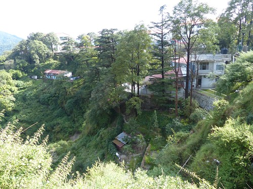
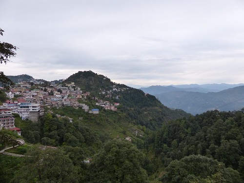
Ajanta Caves
Between 200 BC and 150 AD (thereabouts), workers dug into the hillsides to create caves where the monks could live, study and worship. Some were simple caves with small living quarters and rock beds. Some caves featured stupas, symbolic mound-like structures that were carved out of the solid rock as the space was excavated. Buddhists of that era revered the stupa, which was topped by a shelf for Buddhist relics (an eyelash here, a fingernail there). Cave construction took a hiatus for awhile, but resumed in the 5th century. By then, Buddhism had entered a new phase that included worshipping images of Buddha himself at all stages of his life and in all sorts of symbolic postures. However, soon Hinduism gripped the region, and the caves lost their appeal to everyone but local goatherds. Forgotten by the outside world for more than 1,000 years, they were lucky to escape the medieval Muslim invaders, who decimated many of the region’s other sacred sites.

Why were the caves carved HERE? According to Lonely Planet:

Located close enough to the major trans-Deccan trade routes to ensure a steady supply of alms, yet far enough from civilization to preserve the peace and tranquility necessary for meditation and prayer, Ajanta was an ideal location for the region’s itinerant Buddhist monks to found their first permanent monasteries. … In its heyday, Ajanta sheltered more than 200 monks, as well as a sizable community of painters, sculptors and labourers employed in excavating and decorating the cells and santuaries.

Untitled

Eventually, a British soldier on a hunting expedition spotted one of the caves from a hilltop. He started the unfortunate tradition of scratching his name and date into the ancient cave paintings – John Smith, 1819. Tourists now throng to these caves, which are slowly deteriorating. While security guards and tour guides can help deter graffiti artists, there’s no stopping Mother Nature and her annual monsoon assault. Rainwater seeps through the porous rock, collecting in buckets as it drips from finely painted ceilings.

viewpoint

The UNESCO World Heritage site features 29 caves lining a modern-day sidewalk. Their very existence would be fascinating enough, but the cave walls host surprisingly preserved paintings revealing influences from China, Greece, Egypt, Persia and other parts of the world. Murals tell stories from Buddhist (and later, Hindu) mythology, battles, local history and everyday life.

Rahman led us to the oldest caves first. He pointed out windows and arches sculpted in the shape of a peepal tree leaf. Buddha found enlightenment under the peepal tree, also known as a bodhi tree, so its distinctive leaf is both lovely and symbolic. Here’s a peepal leaf-shaped lintel over the door to a monk’s simple bedroom.
Untitled

Cave 9 dates from the 1st century BC but has some paintings that were added 600 years later. Its vaulted ceiling was originally braced with superfluous wooden beams and rafters.
Untitled

In Cave 10, we saw John Smith’s scrawl (which was hard to photograph in the dim light)…
P1030136

… as well as some stunning paintings.
Untitled

Marina, Kathryn, Lloyd, me and Nancy striking some of Buddha’s famous postures.
Untitled

After introducing us to a few caves, Rahman set us free for awhile.

This elderly lady opted for a ride with the “dhooli-wallahs” (sedan-chair porters).
Untitled

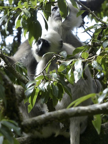
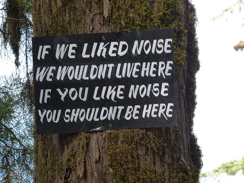
For the most part, we didn’t have to battle for space with other tourists. There were busloads of visitors, but the site was spread out enough to give everyone plenty of space. And people seemed to follow the rules outlined on this sign. The only shouting we heard was from a big group of school kids who discovered a classmate-sized langur monkey in their midst.
Untitled

I have to admit I did tease my friends a bit and even snapped a few unauthorized photos … like this one. Rahman said many Buddhist monks from around the world make a pilgrimage to see the caves.
Untitled

Cave 26 featured a larger-than-life reclining Buddha on his deathbed, blissfully drifting off to nirvana and into the arms of flying angels and musicians.
Untitled

On the opposite wall, seven evil sisters fail in their attempt to seduce Buddha while their satanic father Mara watches from his perch on an elephant.
Untitled

Very little of this cave went uncarved!
Untitled

Cave 19 is considered the finest “chaitya hall,” or shrine, at Ajanta. The sign outside the cave says a feudatory prince was the generous donor for the cave in the 5th century AD.
Untitled

Lonely Planet: “Notice the development from the stumpier stupas enshrined within the early chaityas to this more elongated version. Its umbrellas, supported by angels and a vase of divine nectar, reach right up to the vaulted roof.”
Untitled

Eventually, we walked back to the beginning of the horseshoe to meet up with Rahman and visit Caves 1 and 2.
Untitled

Hanging out with Buddha in Cave 1. Something that always strikes me at historical sites in Asia: We’re not only allowed to enter these caves and get close up and personal with the ancient art. We can actually plop down right ON the ancient art to mug for a photo. It’s both fantastic and tragic.
Untitled

Check out the ceiling in Cave 2. This has survived since around year 500-ish. Insane.
Untitled

Untitled

Lonely Planet explains the painting techniques:

First, the rough-stone surfaces were primed with a 6- to 7-centimeter coating of paste made from clay, cow dung and animal hair, strengthened with vegetable fiber. Next, a finer layer of smooth white lime was applied. Before this was dry, the artists quickly sketched the outlines of their pictures using red cinnabar. The pigments, all derived from natural water-soluble substances (kaolin chalk for white, lamp soot for black, glauconite for green, ochre for yellow and imported lapis lazuli for blue), were thickened with glue and added only after the undercoat was completely dry. Finally, after they had been left to dry, the murals were painstakingly polished with a smooth stone to bring out their natural sheen. The artists’ only sources of light were oil-lamps and sunshine reflected into the caves by metal mirrors and pools of water (the external courtyards were flooded expressly for this purpose). Ironically, many of them were not even Buddhists but Hindus employed by the royal courts of the day. Nevertheless, their extraordinary mastery of line, perspective and shading, which endows Ajanta’s paintings with their characteristic other-worldly light, resulted in one of the great technical landmarks in Indian Buddhist art history.

1401809_10151757879961006_1734632896_o

When we arrived at Ajanta, touts harassed us to buy their wares. As we were leaving the site, the same touts descended.
One said to me, “I am Raj. Remember me from this morning? I have shop with postcards.”
“Hi, Raj,” I said. “I’m sorry, but I already bought some postcards.”
He looked so disappointed and whined, “But I TOLD you this morning, I have POSTCARDS.” Poor Raj.

Ellora Caves
Day 2 of our visit to Aurangabad brought us to Ellora, another series of caves about 100 kilometers southwest of Ajanta. Here, 34 Buddhist, Hindu and Jain caves line a two-kilometer path along a volcanic ridge. This spot was located between two prosperous cities on a caravan route. Right about the time Ajanta was abandoned, a 500-year excavation of Buddhist caves kicked off at Ellora. That was followed by about 300 years of work on Hindu caves, and finally a group of caves from the 9th-11th centuries reveal the local rulers’ adoption of the Jain faith. We traipsed through in reverse chronological order, following the sunlight.

Cave 32 blew our minds. So unassuming from outside the gate …
Untitled

… but chock full of decorative carving inside.
Untitled

The two-story Jain temple was packed with sculpture, including Gomatesvara (one of the 24 religious leaders), who meditated in the forest so deeply that vines crept up his legs while animals and snakes crawled around his feet.
Untitled

The upstairs shrine was dedicated to Mahavira, who taught a philosophy of non-violence and kindness to every living being. Check out the size of these pillars! The whole shrine was carved out of solid rock.
Untitled

This website – The Ellora Caves – includes floor plans and heaps of photos that show what we saw in this cave (as well as all the other caves at Ellora).

From the Jain temple, we took a short ride to see the Hindu group of caves, starting with the most spectacular of all – Cave 16, the Kailash Temple.
Untitled

Not really a cave at all, the temple was carved straight down 107 feet from the hillside. Krishna I initiated its excavation in the late 700s, but the whole project took 100 years to complete. Workers hauled away more than 200,000 tons of rock to reveal a replica of Mount Kailash, the Himalayan dwelling place of Shiva and Parvati. The temple’s snow-like lime plaster coating has mostly chipped away. Rahman pointed out that the temple took the shape of a massive chariot. Lonely Planet explains: “The transepts protruding from the side of the main hall are its wheels, the Nandi shrine its yoke, and the two life-sized, trunkless elephants in the front of the courtyard (disfigured by Muslim raiders) are the beasts of burden.”

The scale of this temple left us all breathless. From the ground looking up, and from the hillside looking down, we couldn’t fathom how such a perfectly proportioned and ornately decorated structure could emerge from the rock. I couldn’t believe I had never learned about the Kailash Temple in school. Its impressiveness ranks up there with Angkor Wat in Cambodia and the temples along the Nile River in Egypt, and yet I would never had known it existed if I hadn’t moved to India. It definitely inspired awe and gratitude on this Thanksgiving weekend.

Here are some details from Wikipedia:

Within the courtyard are three structures. As is traditional in Shiva temples, the first is a large image of the sacred bull Nandi in front of the central temple. The central temple – Nandi Mantapa or Mandapa – houses the Lingam. The Nandi Mandapa stands on 16 pillars and is 29.3 meters high. The base of the Nandi Mandapa has been carved to suggest that life-sized elephants are holding the structure aloft. A rock bridge connects the Nandi Mandapa to the Shiva temple behind it. The temple itself is a tall pyramidal structure reminiscent of a South Indian Dravidian temple. The shrine – complete with pillars, windows, inner and outer rooms, gathering halls, and an enormous lingam at its heart, is carved with niches, pilasters, windows as well as images of deities, mithunas (erotic male and female figures) and other figures. Most of the deities at the left of the entrance are Shaivaite (followers of Shiva) while on the right hand side the deities are Vaishnavaites (followers of Vishnu). There are two Dhvajastambhas (pillars with the flagstaff) in the courtyard. The grand sculpture of Ravana attempting to lift Mount Kailasa, the abode of Lord Shiva, with his full might is a landmark in Indian art.

For much, much more information, check out the Archaeological Survey of India’s website about the Brahmanical Group of Caves.

Untitled

Untitled

Untitled

Untitled

The story of the Ramayana.
Untitled

Big bad-ass Shiva.
Untitled

Inside the shrine.
Untitled

The sacred lingam. Is it sacrilegious that it makes me feel icky?
Untitled

After poking around the temple, we climbed up the hillside to see it from above. That’s Nancy, Lloyd, Kathryn and Katy. Yikes, it was a long way down.
Untitled

Untitled

Untitled

Untitled

Our guide, Rahman (top), sits with his friend, who was the tour guide for another bunch of AES teachers.
Untitled

Well, nothing could compete with the Kailash Temple, but we did pop into one Buddhist cave before leaving Ellora. On the way, we saw these little cuties on a school trip eating lunch in the shade of a tree.
Untitled

Cave 10 is known as Sutar Jhopadi, or “Carpenter’s Workshop,” because of the stone rafters carved in the ceiling. A caretaker opened the second-story balcony for us.
Untitled

Untitled

As we were leaving, a huge group of Indian tourists spotted Katy and accosted her for a photo, but Nancy grabbed her hand and pulled her away. I snapped this shot as I ran for safety.
Untitled

Daulatabad
On the way back to the hotel, we stopped at Dalautabad. I remembered reading in William Dalrymple’s amazing book City of Djinns that the brutal Mughal ruler Tughluq relocated his empire’s capital from Delhi to Dalautabad in 1327, and he forced all of Delhi’s residents to WALK there – an 1,100-kilometer (683-mile) journey. And here we were, at the base of his hilltop fort! (Actually, occupation of the site changed hands many times since it was first used as a capital for Hindu tribes in the 9th century.)

Untitled

Rahman had us pause just inside the gate. He introduced us to the Jama Masjid, a mosque built by Delhi sultans in 1318, and the stone-lined “elephant tank,” which provided water to the fort and irrigated its gardens. We posed with these Muslim school girls on a class trip and shook their popsicle-sticky hands.
Untitled

Untitled

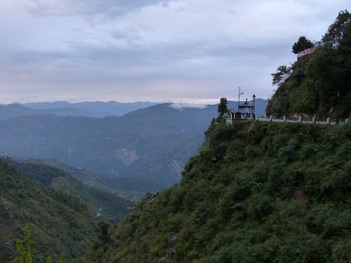
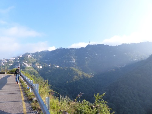
All day, I had been looking forward to climbing this hill, but Rahman said we didn’t have time.
Untitled

Crestfallen, I asked how long it would take to walk to the top. “Two hours minimum,” he said. And how much time did we have to explore the site? “One hour,” he replied. Challenge accepted!

I bolted up the path, taking the steps two at a time. I paused to snap a few shots whenever I thought I was about to hyperventilate. The walkway twisted up and down stairs, through a series of fortifications, over a moat, into pitch-black tunnels reverberating with chirping bats and forking into dead ends before ultimately climbing to a 12-pillared pavilion. Breathless, I checked my time. 28 minutes! I took a quick shot of the pavilion and texted it to my friends with the message, “I made it! I’m about to throw up.”

I dashed into the structure and quickly admired the views.

Untitled

Untitled

Untitled

Untitled

As I prepared to head back down, I spotted one more look-out post perched right on the summit. Doh! Tempting, but I had to skip it.

Untitled

Home Away From Home
Our group stayed at the Vivanta Hotel in Aurangabad. Despite a late afternoon chill in the air, I felt compelled to get in the pool both days. I didn’t mind the cold in my bones when I knew our room had a shower with hot water that lasted long enough to wash my hair AND body, unlike our shower at home. Such a treat!
Untitled

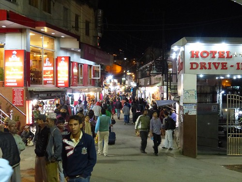
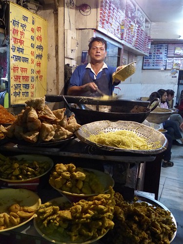
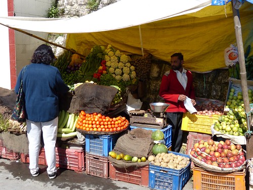
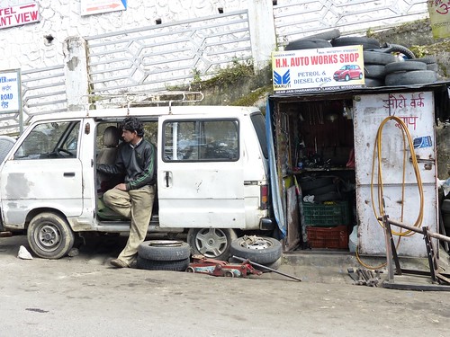
Other notes of local interest …
For some reason, these ubiquitous langur monkeys don’t distress me the way Delhi’s macaque monkeys do. In fact, I kind of love them.
Untitled

Aurangabad’s cattle featured painted horns. Rahman said everyone decorates their animals for a local festival each year in the fall. This guy has an Indian flag theme going on.
Untitled

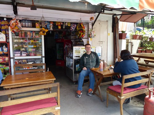
This was an after-lunch breath freshener at the Ajanta Caves restaurant. Fennel seed and sugar.
Untitled